A dedicated UAV magnetics survey system has been developed by Rada Engineering and operated through Thomson Airborne.
A dedicated UAV magnetics survey system has been developed by Rada Engineering and operated through Thomson Airborne.
UAV Magnetics is at the forefront of drone surveying in Australia, and has refined its technology and method to create a system that is fast, efficient and produces high-quality, high-resolution magnetic data for exploration tenements and mine sites.
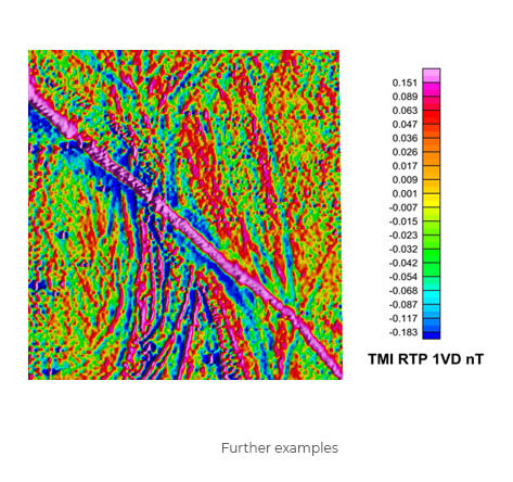
The UAV Magnetics system will locate changes in rock types, and fault structures in a geological prospect which provide critical information for target discrimination, mine operations and mine planning. The system has a proven track record for mineral exploration targets, mineral exploration surveys, environmental surveys, and for detecting dykes and structures in coal operations.
The system has been developed as a result of years of expertise in airborne magnetics surveying, together with highly experienced UAV operators, and in conjunction with the custom magnetometer, is ideally suited for high-resolution magnetic surveys that are up to 2000 line km in size.
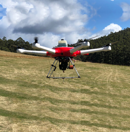
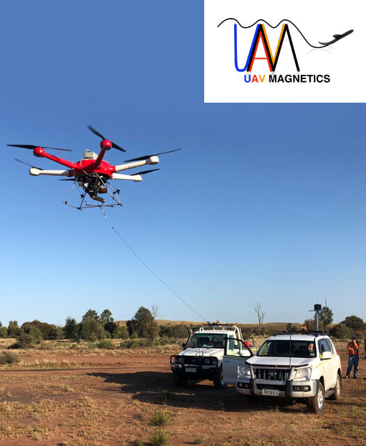
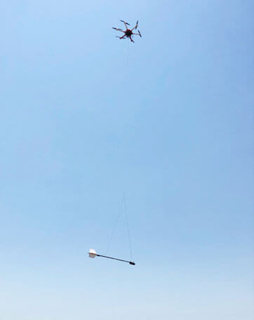
The custom-built hexacopter can fly autonomously for 1.5 hours at a range of 2km from the ground operator, and solves the significant safety risks associated with operating manned aircraft at low altitudes, or using traditional ground magnetics surveying techniques. This is a new generation of technology which is fast, safe and efficient.
New Custom built Fixed wing survey aircraft can fly using Beyond Visual Line of Sight technology (BVLOS) up to 5 km from base station for large area surveys.
| Air Frame: | 3m Fixed Wing Custom UAV. |
| Endurance: | 2 Hrs. |
| Speed: | 25 m/s 80 km/h. |
| Coverage: | 140 km per flight. |
| Air Frame: | Hexacopter, UAV – Hybrid configuration. |
| Endurance: | 1.5 hours. |
| Speed: | Up to 15 m/s, 53 km/h. |
| Coverage: | 50 line km flat terrain, or 30 km 3D terrain. |
| Sample rate: | 50 Hz. |
| Sample interval: | 0.05 – 0.3 metres. |
| Sensors: | 3 Axis high sensitivity Fluxgates. MFAM , and Fluxgate options. |
| DAQ: | 24 Bit synchronous ADC. |
| Sensor Magnetic Noise: | +/- 0.15 nT. |
| LIDAR: | 120m Range, Accuracy 5cm. |
| GPS: | UBIox NEO-M8, 72 Ch. GPS.GLONASS, Accuracy 2m. |
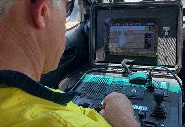
| Data Monitoring: | Real-time QC data transmission to base. |
| Fully Autonomous flight. |
| Latest Military Digital Uplink technology, Range 15 KM. |
| Real time flight tracking at base station. |
| Live video feed to base from UAV. |
| First Person View Camera for co-pilot. |
| Post-processed manoeuver compensation. |
For further information or a formal quote, please contact Paul Rogerson,
here at Thomson Airborne.