Our Equipment

PRODUCT RANGE
Our Equipment

RS-500 Airborne Gamma Ray
Spectrometer

The RS-500 is the most advanced airborne gamma-ray spectrometer system utilizing leading edge DSP/FPGA technology for previously unachievable levels of spectral data performance.

RSI has applied extremely advanced technologies to the RS-500 systems making obsolete all current available systems by a significant factor. Nonetheless it is designed to be easy to interface and virtually fool proof to use, making the RS-500 system the clear technological leader in this sophisticated field.

Rsx-4 Airborn Detector Pack

256 CU INS – 4L
Sodium Iodide
XTAL Assembly

256 CU INS – 4L
Sodium Iodide
XTAL Assembly

256 CU INS – 4L
Sodium Iodide
XTAL Assembly

256 CU INS – 4L
Sodium Iodide
XTAL Assembly
RS-ADS
Spectrometer Module

RS-ADS
Spectrometer Module

RS-ADS
Spectrometer Module

RS-ADS
Spectrometer Module
DPU
Data Processing Unit

Power Supply

Unique Features

  • State-of-the-art design using FPGA/DSP technology.
  • Each xtal output is fully linearized permitting multi-xtal summing with no distortion.
  • No requirement for radioactive sources for system setup.
  • No requirement for radioactive sources for system validation.
  • Unlimited number of xtal summing.
  • Greater than 20x improvement on signal throughput compared to older systems.
  • Fully automatic gain stabilization on natural isotopes world wide.
  • Each xtal pack operates independently.
  • System readily integrates into users data systems.
  • Individual xtal data storage with no increase in data volume.
  • Post-flight analysis techniques effectively eliminate re-flies for data problems.
  • Easy to integrate system, with very straightforward user interfaces.

Technical Specifications

Spectrometer DPU Detector Outputs Inputs
Channels:
1024

Differential non-linearity:
<0.2% over top 99.5%

Integral non-linearity:
<0.01% over top 99.5%
Zero dead time(*)

Baseline restoration:
Digital (IPBR) (**)

Pulse shaping:
Digital (AOPS) (***)

Pile-up rejection:
Digital (<40nS)

Pile-up contamination:
<0.1% @ 250kcps
I/O:
Ethernet

Sample rate:
0.1-10 per sec

Timing:
Internal/External

Gain stabilization:
Automatic multi-peak
RSX-4
4 x 4L NaI (Tl)

RSX-5
4+1 x 4L NaI (Tl)

Energy resolution
<8.5%(****)
Composite spectrum
Individual spectra
State of health
Detector configuration
Operational parameters
Trigger signal
Calibration data
Notes :

(*) The RS-500 has no dead time in a traditional sense. A live time clock will be adjusted for loss of system measured pile-up rejections to give an apparent dead time to ensure the absolute count rate is correct.

(**) IPBR – Individual Pulse Baseline Restoration. The baseline is established for each individual pulse for maximum pulse height accuracy.

(***) AOPS – Automatic Optimized Pulse Shaping. Pulses are continuously analysed and the signal pulse shaping adjusted for optimum performance.

(****) Stated energy resolution is for new systems. Refurbished system performance depends on quality of xtals supplied.

USER BENEFITS of the RS500 SYSTEM

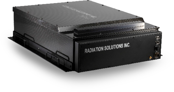
1. NO TEST SOURCES needed for SYSTEM STARTUP STABILIZATION

In the past most users had Cesium sources for in field start-up stabilization but with the ever increasing difficulty of radioactive source shipments, a better solution was needed. The RS500 system uses MULTIPLE-PEAK Gain Stabilization on natural isotopes. In all locations on the earth’s surface there are varying amounts of K, U and Th in the rocks/soils. The RS500 uses very advanced algorithms to utilize these spectral signatures to achieve fast high quality stabilization for system start up. The system uses statistical techniques to verify correct stabilization by computing spectral Quality-of-Fit to automatically advise users when the system is ready to go. Data tests shows that GOOD fit could be achieved in typically 20 seconds under normal low background conditions (30 Gy/h) and a VERY-HIGH quality fit within a few minutes under essentially any geological conditions.

2. NO TEST SOURCES needed for SYSTEM IN-FLIGHT OPERATION

The same analysis algorithms described above are also used for in-flight stabilization. The use of MULTIPLE-PEAKS for Gain Stabilization ensures highest confidence and quality performance under any local geological conditions.

3. NO TEST SOURCES needed to VERIFY SYSTEM PERFORMANCE

A common requirement in geophysical Surveys is the need to carry out GROUND CHECKS using Uranium and Thorium sources to prove that system performance is being maintained. These sources are also very problematic for legal transportation. The RS500 implements a special feature that has “perfect” spectra in memory for the Potassium, Uranium and Thorium spectra that are geologically prevalent. Prior to flight, as the system performs it’s automatic pre-flight stabilization described in item (1) above – at the automatic end of this test the accumulated spectra are fitted to the “perfect” spectra in memory and a Quality-of-Fit for K, U and Th is determined. These data are used to PROVE that system performance is within the required ranges. RSI will develop a peer-reviewed paper to explain this technological advance that can be used to satisfy local in-field Customer Quality control requirements.

4. SPECTRAL DATA STORAGE

The RS500 can be sampled at any setting between 0.1sec/sample and 10 sec/sample but in normal Geophysical applications a 1 sec data rate is normally recommended, however very low ground spacing users may operate at a higher rate. A typical system operates with 9 xtals (8 DOWN and 1 UP). The RS500 uses advanced data compression methods to compress data typically by 10x. For this reason RSI recommend that the RAW data from ALL xtals are recorded in the data system. A 9 xtal system operated at 1/sec would generate fully compressed 1024 channel spectral data for ALL xtals of typically 7MB/HOUR, a relatively trivial data storage requirement for today’s data systems (note that currently at 1 sec data – recording UP and DOWN uncompressed data = 14MB/HOUR!).

5. SPECTRAL DATA VALIDATION

The huge advantage of ALL SPECTRA data storage is that RSI can provide the user with a Utility program that reads all the COMPRESSED data stored, analyses ALL individual spectra for Quality-of-Fit and provides the user with this result for QC control. If ALL spectra are OK the Utility then sums them to provide the UNCOMPRESSED spectra for summed DOWN and UP xtals for user data analysis.

6. SPECTRAL DATA RECOVERY

In the event that the analysis process shows serious data errors on any of the spectra, RSI can provide data tools and services to remove the problem data PRIOR to summing to avoid data contamination. In many cases RSI can also help the users resample the BAD data to correct it and permit the majority of the bad data to be reused.

These 2 features (5+6) means that re-flies for bad data quality should be almost eliminated.

G-823 Airborne Cesium
Magnetometer

This new G-823A magnetometer includes the well proven high performance G-823A sensor. It provides unmatched versatility of performance, size, function, and cost effectiveness.

The system’s high performance and multi function capability are excellent for mapping geologic structure, for mining, oil and gas exploration and environmental surveys.

Reliability is very high. The specialized Cesium (non-radioactive) components are stable and not subject to limited life or early failure. Even after years of operation, full conformance with original stringent specifications can be expected.

Unique Features

  • Airborne and vehicle applications with multi-sensor array capability.
  • High sensitivity.

ZDAS Acquisition / Navigation System

The Zdas acquisition and navigation unit (all in one) was conceived to fill a role of combining the necessary functions of navigating an airborne platform accurately and recording the parameters in one small integrated system.

This was deemed necessary to prevent the proliferation of computers that appears to be invading most aircraft with the problems of ensuring that they’re all running correctly and synchronised with each other.

The Zdas reads the GPS positions and immediately tags the incoming streams of data with a precision counter and the last good position coordinates that the on board GPS receiver provided.

These are written to a file in a sequential mode in order to preserve the spatial integrity of the incoming data streams.

In addition it provides command information to the pilot in an aviation friendly display that has been optimised to give intuitive guidance during the critical phases of low level flight where extraneous information is both distracting and dangerous.

The aim was to package the system in the smallest case that allowed fitment to small utility helicopters and fixed wing platforms.

(Images and text may not reflect the exact current version as both the software and hardware change with time due to product improvements).

Website: www.georesults.com.au
Email: peter.m@georesults.com.au

ZDAS Specifications and Features

  • Integrated Novatel OEMV-1 GPS receiver providing positional information that is used to tag incoming data.
  • Streams in addition to providing pilot navigation guidance.
  • Compact size and weight allowing strap-down installation in helicopters and light aircraft (Dimensions 29cms x 21cms x 10cms with
    weight a little over 2 kg).
  • Four Serial ports (RS232).
  • Eight differential 16 bit analogue inputs (+/- 10v).
  • Two external USB ports.
  • One video port (SVGA).
  • Sample rates up to 20Hz.

Versatile interface options utilising some of the above ports, linking to a variety of accessory equipment including:

  • High brightness VGA display showing both data acquisition readings and flight information.
  • Small navigation screen (iPAQ PDA) screen displaying “xtrack”, “height offset” and much more.
  • High precision Cs magnetometer counter input.
  • Analog fluxgate input.
  • Radiometrics (Gamma-Ray Spectrometers) input suiting RSI or Exploranium xtal packs.
  • Video overlay (on screen display) output of key variables to an external digital video recorder.
  • Temperature / Humidity sensor.
  • Barometer (option of external or internal to Zdas enclosure).
  • Radar Altimeter / Laser range finder.
  • Current or voltage monitoring.

Kroum KMAG4 Magnetometer
Counter

  • High precision (0.001nT’s).
  • High Sample rate capable (100 samples/sec).
  • Flexible and rigorous triggering option.
  • Data integrity reporting.
  • Lightweight and low power consumption.

Bendix-King KR-405B
Radar Altimeter

  • Operating Altitude 0-2000ft (0-627m).
  • Accuracy: better than 5% from 0-500ft.
  • Power requirements 28v at less than 1 amp.
  • Direct readout and alarms for pilot.

Novatel OEMV-1 GPS Receiver
Module

  • Can be integrated internally to the Zdas acquisition unit.
  • Horizontal Positional Accuracy (RMS) 1.5m Autonomous and down to 0.4m with DGPS corrections.
  • Also available is a Glonass model and L1L2 dual frequency card options.
  • Versatile triggering output options.

GT-2A Airborne Gravimeter

The GT gravity technology was designed by award winning engineers in Moscow in partnership with CMG. The GT-2A is based on
7 years of operational experience with the GT-1A which brings proven design and fully automatic operation to mobile scalar
gravity measurement.

Improvements

  • Increased sensitivity.
  • Wider dynamic range.

Advantages

  • More precise measurements.
  • Reliable performance in high turbulence.
  • High productivity.
  • Aircraft-independent operations.
  • Fully automated recording.
  • In-field quality control.
  • In-field production of preliminary free-air gravity maps.

The very large dynamic range provides high precision data even in turbulent flying conditions. Data is acquired through short periods of saturation in extreme turbulence by the automatic application of a reduced order Kalman filter, enabling platform misalignment to be computed and hence controlled. The automatic calibration program computes accelerometer scale factors and errors in perpendicularity between the accelerometer sensitive axis and the platform surface.

Fig. 1.Illustrates a GT-2A installation in a fixed wing aircraft (courtesy of Airborne Petroleum Geophysics Ltd).

The GT-2A is hermetically sealed for protection when operating in environmental extremes. Short lead-ins improve survey efficiency and reduce costs. Filters depend on aircraft speed and flight conditions and provide spatial resolution typically ranging from 1.2 kms to 3.5 kms.

Fig. 2. Repeat lines flown with the GT-2A in Nov 2008 in Ontario, Canada with RMS accuracy = 0.5 mGals.

Fig. 3. Tight drape repeat line over the Vredefort Dome,South Africa, with RMS accuracy of 1.2 mGals.

Fig. 4. Fixed-wing survey over the Vredefort Dome SW of Johannesburg (NS lines spaced 1km apart).

Left image is ground data courtesy of the Geoscience Council of South Africa.
Right image is the GT-2A data (acquired in March 2009 courtesy of Airborne Petroleum Geophysics Ltd). The accuracy for the survey was 0.6 mGals RMS.

Fig. 5. Magnetic and Radiometric data were also acquired with the GT-2A gravity data during the March 2009 Vredefort Dome survey.

Top left = Total Magnetic Intensity.

Top right = Ternary image.

Bottom left = Total Count.

Bottom right = DEM.

(Images courtesy of Airborne Petroleum Geophysics and Xcalibur Airborne Geophysics.)

Specifications

Measurement range 9.75to9.85m/sec2
Dynamic range >+/- I,00O Gals
Drift per day (corrected) < 0.1 mGals
RMS error in gravity anomaly estimation (static mode up to 12 hours on tench) RMS error
0.6 mGals (+/-1 LSD*)
Attitude limits roll +/-450
Pitch +/-450
Operating temp +50C to +500C
Power operating       150 W at 27Vdc
standby       5OW at27Vdc
Weight (with base) 153-5 kg
Dimensions console 400 x 400 x 600 mm
Dimensions base 600 x 300 mm
Service life 30,000 hours
Error in gravity anomaly estimation (RMS) 0.01 Hz cut-off
0.6 irGals (+/-1 LSD*)

*Least Significant Digit specifications subject to changes.